TO CREATE NATION’S FIRST COMPREHENSIVE INTERACTIVE ROW MAP
For any state department of transportation, having an accurate, complete, and easy-to-use map of land assets is essential. That was the starting goal of the Nevada Department of Transportation (NDOT), and in two years, it has set the standard with its Rights of Way Survey Services GIS App developed by Civix.
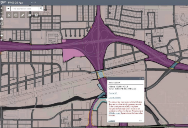
Within a few clicks, the interactive ROW map provides details on 100% of control sections and 99% of the state’s ROW boundaries for roadways – about 5,000 miles in total. In fact, Nevada may be the first state in the U.S. to have its ROW interests mapped to this level of completeness.

This is a notable achievement, and with it, Nevada is setting the bar for ROW mapping.
-Mark Goetz
Civix GIS Director
Backed by a deep bench of ROW experts, he played a leading role in developing Nevada’s innovative new technology.
TECHNOLOGY & EXPERTISE
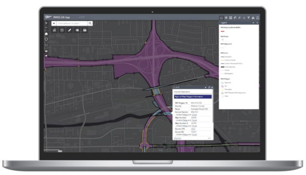
The complex process of developing the app involved digitizing thousands of scanned map records and compiling them with survey and CAD data into an interactive GIS map. The innovative technology enables users to click an area to view the source records used to create the geometry.
Compiling survey data required a high level of skill above and beyond mapmaking. Experts pieced together thousands of data points to create a complete map of the state’s interests (in fee, easement, and prescriptive rights). Through the exercise, NDOT was able to resolve problems and conflicts in source mapping to create a seamless, complete GIS map.

Throughout the course of building the GIS mapping, NDOT discovered it could leverage the process to discover and remedy issues. It was able to verify – and identify deficiencies – in source information. The Department also was able to identify surplus interests – information it could use to mitigate risks and generate revenue.
A NEW RESOURCE FOR COUNTIES
Not only is this tool enabling NDOT to advance its mission and to uphold its duty as a steward of land and infrastructure, the Department plans to make the interactive ROW map publicly available. This will empower local governments with accurate data and common boundaries that can be applied to update their mapping.
AN AGILE WORKFLOW
Mapping more than 5,000 miles of roadway relying on thousands of source documents took a lot of determination, organization, and collaboration.
NDOT excelled in each area to account for all its statewide land interests, be it by fee, easement, or prescriptive. To do this, Civix worked with the Department to adopt an Agile workflow, which is made up of a distinct set of stages involved in completing a project, from ideation to completion.
SAVING TIME & RESOURCES
NDOT estimates that staff was spending about 200 hours per month verifying ROW. For approximately two years, they have been increasingly able to realize significant time savings as the interactive ROW map has been developed. Now, staff can click a ROW polygon to access the document management system and verify ROW in just a few minutes.

This is a huge time-saving tool, and it’s allowing staff to focus on the big picture while empowering others with critical ROW information.
-Mark Goetz
Civix GIS Director

Querying and visualization can be performed through an easy-to-use web interface, streamlining the number of requests to “make maps and access source authoritative maps and documentation.
A NEW BEST PRACTICE STATES CAN REPLICATE
With its interactive ROW map, NDOT has set a new standard for how ROW programs should be managed. The interactive ROW map is easy to replicate. The technology is configurable, flexible, fast to implement, and can scale to meet each jurisdiction’s budget and goals.

Nevada shows how innovative tech, coupled with our deep knowledge of ROW and land records, empowers governments to make informed decisions, determine land ownership, use, rights, and legal responsibilities and take appropriate action. They’ve made a modest investment that will benefit the management of public land assets and ROW for decades to come.
-Mona Nosari
Civix’s Vice President of Right of Way
BENEFITS
∙ Faster Shovel-ready Projects
∙ Save Staff Time
∙ Improve Efficiency
∙ Ensure Accuracy
∙ Mitigate Liability
∙ Generate Revenue from Surplus
∙ Confirm Assets are within ROW
∙ Resolve Roadway Outside of Easements
Contact
How can we help?
Contact our team today to learn more about our products and services for your industry.
