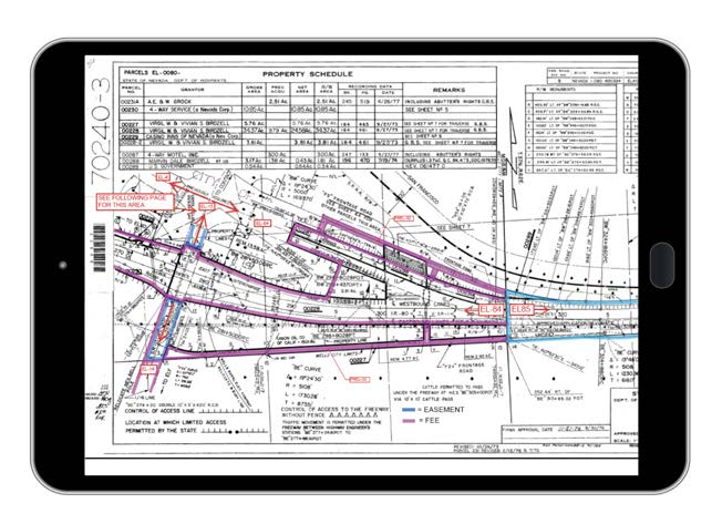
A Total View of Land Assets
Civix’s Land Information Management System (LIMS), backed by our unmatched
Right of Way (ROW) expertise, provides state and local governments and their constituents with an accurate and complete GIS mapping of land assets.
STEP ONE FOR INFRASTRUCTURE
Building and maintaining infrastructure – everything from roads and utilities to drainage and flood protection – is a core function of government. Essential to this function is a complete and accurate view of land rights. As one state official wisely put it, “You can’t manage what you don’t map.” That’s where we come in. Our advanced LIMS solution coupled with our unmatched knowledge of ROW and land records empowers governments by providing the information needed to make informed decisions, determine land ownership, use, rights, and legal responsibilities and take appropriate action.


THE HIGHEST LEVEL OF ACCURACY
What sets our solution apart is the pinpoint precision with which it maps land assets. Leveraging leading-edge technology, unrivaled expertise, and virtually every form of data, we’re able to present accurate and authoritative records.
POWER SELF SERVICE
A simple, interactive mapping portal puts the power of geospatial technology into the hands of every authorized user. Querying and visualization can be performed through an easy-to-use web interface, streamlining the number of requests to “make maps” and access source authoritative maps and documentation.
BENEFITS
Saves Time
Significantly cut staff time spent on ROW information requests
Improves Efficiency
Provide a dataset that can be used by all departments & agencies
Empowers Staff
Offer an online portal to easily access data from anywhere
Informs Action
Confidently make decisions to move projects forward
KEY FUNCTIONALITY & FEATURES
Converts CADD to GIS: Expertly convert CADD files into reliable GIS data & develop lifecycle strategies and ETL tools for future maintenance.
Creates ROW Layers: Generate ROW boundaries based on a variety of source documents including deeds, land surveys, CADD, aerial imagery, milepost database entries & alignments.
Achieves Accuracy: Advanced use of geodetic & survey data & a tested QA/QC process ensures the quality & accuracy of points, polylines, polygons & attribute data.
Hard Copy to Digital: Generate ROW from a variety of sources using appropriate methods depending on the source information & associate GIS features with their source information references.
Fills in Gaps: Verify source information is adequate to produce the desired GIS mapping output and identify deficiencies in source information.
Provides Online Access: Create interactive mapping that combines GIS data with integrations to a variety of systems. Financial system & other project application integrations offer a single point of access to your data.
Manages Project Lifecycle: Track appraisals, surveys, cost estimates, project teams & more. Workflow features improve productivity by automating task assignment and document approval processes.
BACKED BY THE EXPERTS
Our project managers, land specialists, GIS specialists, and planners have proudly served federal, state, and local public agencies, special districts, and transportation authorities for over 40 years. We are highly trained in the laws and regulations appropriate to managing ROW, including the Uniform Relocation Assistance and Real Property Acquisition Act (URA), 23 CFR 710 and associated state and local requirements.
BORDER TO BORDER MAPPING, STARTING AT THE CENTERLINE
We have extensive experience managing rights of way for projects large and small, from hundreds of miles of flood protection in Louisiana to all state ROW boundaries for roadways within Nevada – about 5,400 miles of highway.
40
Years
Developing Land Records & ROW Data Sets
20
Years
As an ESRI Silver Business Partner
Microsoft
Gold Partner
With PMP, GISP Certified & Agile Project Managers
LEVERAGE FEDERAL FUNDING & INVEST IN THE FUTURE
The federal government’s recent and historic multi-trillion dollar investment in our nation’s infrastructure makes now the perfect time for state and local governments to leverage newly available funding for ROW GIS mapping initiatives which represent a modest but essential investment in the coordinated management of public land assets and ROW for decades to come.
Contact
How can we help?
Contact our team today to learn more about our products and services for your industry.
